huffpost Press
A ‘Super El Niño’ Is Said To Be Coming — 'The Gun Is Loaded,' Meterologists Say
Images
1 / 10

2 / 10

3 / 10
4 / 10
5 / 10

6 / 10
7 / 10
8 / 10
9 / 10

10 / 10
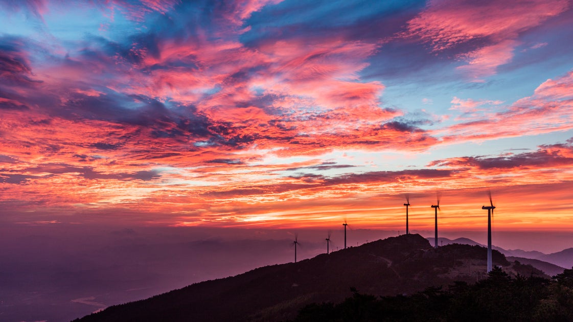
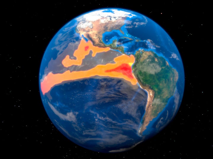
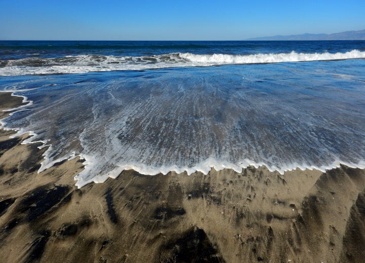
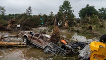
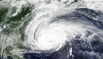
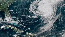
Bomb cyclone. Polar vortex. Atmospheric river. There’s no shortage of intense-sounding terms in the world of meteorology. This week, it feels like “super El Niño” headlines are suddenly everywhere.

New forecast data has scientists watching the Pacific Ocean closely and considering whether a rare, unusually strong climate pattern could be taking shape. But what does that actually mean? And how worried should we be?

Below, meteorologists break down what you should know about a potential “super El Niño.”

At its core, El Niño is about ocean temperatures, but it’s really an ocean-atmosphere partnership.

“An El Niño begins as a warming of water temperatures in the eastern tropical Pacific,” said Matthew Cappucci, a senior meteorologist at MyRadar. “It’s the opposite of La Niña. The two are opposite ends of a pendulum-like cycle in the atmosphere and oceans.”

That cycle is known as the El Niño Southern Oscillation, or ENSO.

“Typically, an El Niño has happened every 3 to 4 years since 1950,” said Jonathan Erdman, a senior meteorologist for The Weather Channel app and weather.com.

That means El Niño is part of a naturally occurring rhythm in Earth’s climate system, even if each event looks a little different.

“El Niño is just an area of warm water ― compared to average ― along the equator in the Pacific Ocean stretching from the South American coast to around the dateline, 180 degrees longitude,” said Kyle Leahy, a lead meteorologist with WeatherWorks.

Basically, when surface water temperatures are warmer than average in the eastern equatorial Pacific Ocean, you have El Niño. When temperatures there are cooler than average, it’s La Niña.

“The process begins when the trade winds that blow east to west across the central and eastern Equatorial Pacific slow down,” said Paul Pastelok, a senior meteorologist and lead long-range forecaster with AccuWeather. “This slows or stops the process of upwelling cooler water from the deep ocean to the surface.”

As a result, warmer water builds at the surface, which sets off a chain reaction in the atmosphere.

“It’s a little patch of water, kind of in a remote place that not a lot of people live, but it really has an outsized impact on what weather and climate are like worldwide for a long period of time,” said Ryan Truchelut, president and chief meteorologist at WeatherTiger. “Those water temperatures act as a kind of global weather pattern pacemaker. It’s a feedback cycle that provides us some predictability for the next 6-12 months, or even sometimes up to two years.”

Some El Niños are stronger than others, and occasionally, they reach “super” status. That means the water is particularly warm compared to average in the center of that key region of the Pacific.

“We measure the strength of an El Niño or La Niña based on how warm or cool the waters are relative to normal in the tropical Pacific,” Cappucci said. “For a ‘super El Niño,’ water temperatures run about 2 degrees Celsius, or 3.6 degrees Fahrenheit, above average.”

By comparison, a “weak” event involves temperatures from 0.5 to 0.9 degrees Celsius above average (0.9 to 1.6 degrees F), and a moderate event would be between 1 and 1.4 degrees C above average (1.8 to 2.5 degrees F). A strong event reflects 1.5 to 1.9 degrees C higher (2.7 to 3.4 degrees F).

“Super El Niños are a relatively rare event,” said Nathan Hamblin, a meteorologist and senior long-range weather risk communicator for the weather data service DTN. “They happen maybe once every 15 to 20 years on average.”

He noted that the last two occurred during the 2015–16 season and the 1997–98 season.

“The pendulum swings from El Niño to La Niña (and vice-versa) every two to seven years on average,” Cappucci said. “Each phase is most pronounced in the wintertime. In recent years, the world’s oceans have been warming so much that it’s easier to get super El Niños.”

“The conditions right now are just about ideal to create a stronger event,” Hamblin said. “So some of our forecast model guidance is predicting that outcome.”

He noted that strong El Niño events tend to peak in the fall. So even if we get a “super El Niño,” that doesn’t necessarily mean we’d feel it this summer ― though we should have a better sense of what to expect for the fall and winter by then.

Pastelok is seeing more rapid changes this year, however.

“The sea surface temperatures are quickly changing in the equatorial Pacific, so fast that this El Niño could begin in June,” he said. “Most El Niños and La Niñas begin in the fall. This El Niño will most likely begin soon and strengthen quickly. However, that timing of intensification can change, faster or slower.”

He pointed to factors like the warming of subsurface waters in the central and eastern Pacific, shifts in the Indian Ocean that favor El Niño development and warming waters between Hawaii and Baja feeding into the equatorial region.

“Some of these recent westerly wind pushes have been just as strong now as they were during stronger El Niño seasons in the past,” Hamblin noted. “So I think the model guidance is latching onto that, and meteorologists suspect a strong possibility of a stronger or even super El Niño even this season.”

The gun is loaded, the water beneath the surface is warmer than average. The right weather event can kick this feedback cycle into gear.

“Just because some of the guidance says so doesn’t mean it’s going to happen,” he said. “There’s no guarantee right now. It could fall short, or just be a moderate or slightly above-average El Niño.”

Although some current atmospheric factors are contributing to this potential outcome, Leahy similarly advised caution.

“It’s a bit too early to have all that much confidence on it getting quite that strong,” he said. “I think that a strong El Niño is likely, but super is up in the air still.”

Forecasters are currently facing what’s known as the “spring predictability barrier,” a phenomenon where climate models and ENSO forecasts are less reliable from March to May.

“Still, we see the potential,” Truchelut said. “The gun is loaded, the water beneath the surface is warmer than average. The right weather event can kick this feedback cycle into gear.”

“An El Niño is not a storm. It does not affect you directly,” Pastelok said. “It is a cycle that contributes, like many other factors, to produce weather changes and sometimes extremes.”

Every El Niño is different, and is not the only influence on weather patterns at any given time. But it’s certainly a notable one.

“This matters because El Niño can affect global weather patterns for months, including near and over the U.S.,” Erdman said. “The stronger the El Niño, the stronger the thumbprint on these weather patterns.”

A super El Niño could signal positive weather news for some parts of the U.S., at least in certain aspects.

“Stronger El Niños tend to suppress Atlantic Basin hurricane development, especially in the Caribbean Sea,” Erdman said, noting that hurricane risk can be reduced in these times due to wind patterns that are unfavorable to these storms.

“However, that doesn’t mean the 2026 Atlantic season will be a complete dud,” he added. “In 2023, Hurricane Idalia struck Florida during a moderate to strong El Niño. Even in quieter hurricane seasons, there can be that one hurricane that strikes land and is remembered forever.”

Even in a season with very few hurricanes, it only takes one bad one to bring catastrophic destruction.

“We’re also likely to see warmer-than-average conditions across the northern U.S., especially in the winter, and cooler, wetter conditions in the South,” Cappucci said. “Florida may experience a more active winter severe weather season and heavier cool-season rainfall.”

Hamblin said there’s a good chance of “some very warm stretches across the northern U.S., from Chicago through Boston, New York, Philadelphia and Washington, D.C., in the winter.”

There might be cold, short stretches as well, but the longer ones would likely be warmer and drier in the northern parts of the U.S.

“The impacts definitely become more noticeable in the winter, and with a strong El Niño, warm temperatures are favored in the northern tier of the country, and snowfall is usually dependent on one or two large storms,” Leahy echoed.

On the flip side, you might see “stronger, wetter” storms down south, Pastelok noted.

“You tend to have a little bit more opportunity for precipitation across the southern U.S., especially like the Southern Plains through the Gulf Coast,” Hamblin said.

This surge of moisture might also raise the risk of flooding and other issues in some areas as a result.

“The change in the ocean water temperatures can lead to changes in the upper-level patterns across the globe. Air can sink and rise over different locations, leading to drier or wetter conditions respectively,” Pastelok said. “El Niño has a greater impact on the tropical regions of the globe, causing more drought in Australia, wetness in eastern South America, drier in Indonesia.”

In general, you get a mixed bag of weather outcomes in strong El Niño years.

“A lot precipitation could help us catch up on long-term drought, but unfortunately, it could also come in the form of dangerous severe weather and damaging winds, tornadoes,” Truchelut said, adding that severe weather can be more extreme in these years.

In addition to acute events, there are also broader implications for global temperatures.

“The planet’s temperatures usually spike during El Niños, which means 2026 and possibly 2027 will likely become the planet’s record warmest years since at least the late 19th century,” Erdman said.

Ultimately, a super El Niño has the potential to bring a range of outcomes, but meteorologists are watching closely. In time, a fuller picture will come into focus for the coming season. And there’s still variability within any outcome.

“When we’re talking about ENSO, it’s always about identifying seasonal trends, but day to day, weather can shift a lot,” Hamblin said. “So just because there’s a lot of warm and dry days during the winter, we have to still be on the lookout for those short stretches that can sneak up on you. And they can be more impactful.”

By entering your email and clicking Sign Up, you're agreeing to let us send you customized marketing messages about us and our advertising partners. You are also agreeing to our Terms of Service and Privacy Policy.