yahoo Press
Strong tornadoes, giant hail possible for 6 million Michiganders, timeline is clear cut
Images

1 / 15
2 / 15

3 / 15

4 / 15

5 / 15

6 / 15

7 / 15
8 / 15
9 / 15
10 / 15
11 / 15
12 / 15

13 / 15

14 / 15

15 / 15
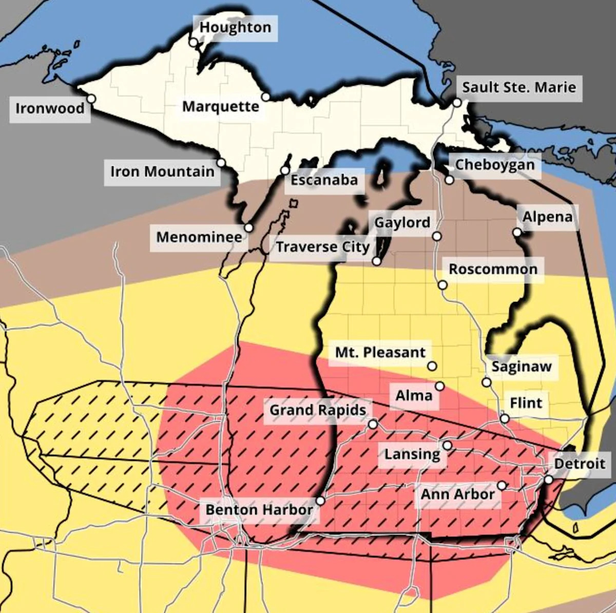
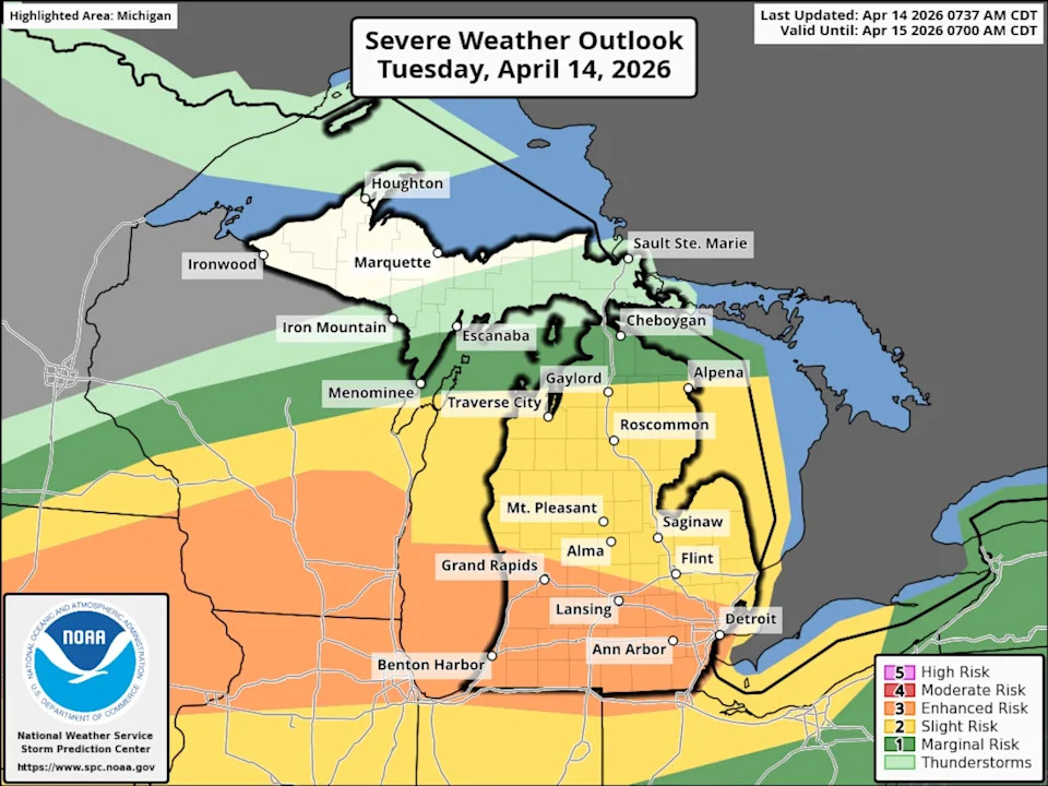
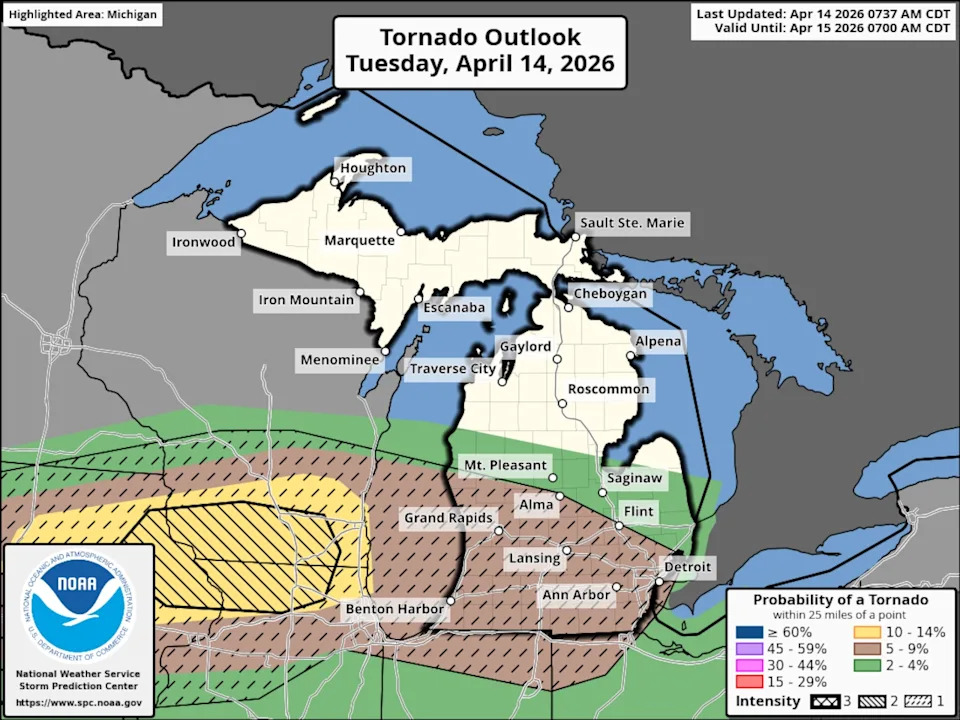
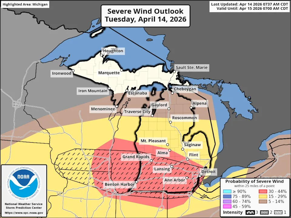
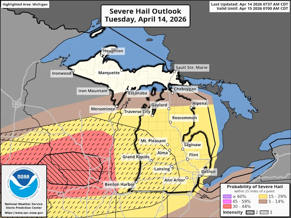
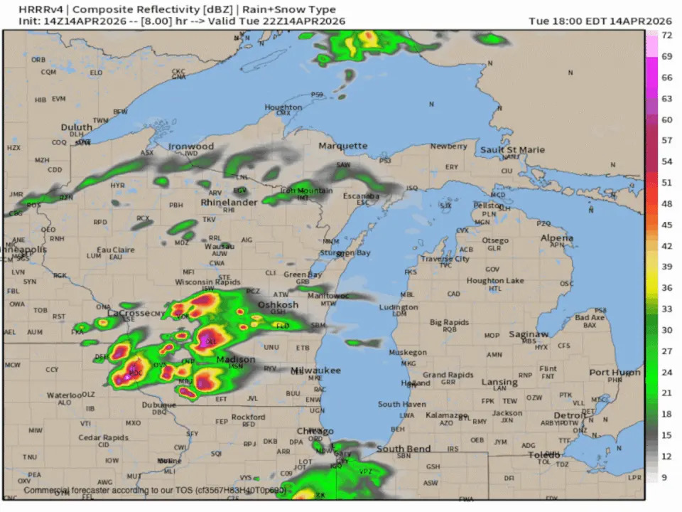
The Storm Prediction Center has targeted the most populated part of Michigan for possibly some significant severe thunderstorms this evening. The atmospheric conditions are in place for damaging hail and a few strong tornadoes. There will also be a higher chance of numerous severe wind gusts as the evening progresses.

The best place to start is the breakdown of what parts of Michigan are in the chance of the three forms of severe weather: tornadoes, wind gusts and large hail.

First, here’s the overall severe weather expectation. The orange area from Muskegon, Grand Rapids, north of Lansing, Ann Arbor, Detroit and all areas southward have the highest chance of any severe weather. The orange denotes a level 3 risk out of five levels.

The tornado possibility forecast has the brown shaded area of southwest, south-central and southeast Lower Michigan in a five to nine percent chance of a tornado within 25 miles of any point. The black hatching means any tornado could be a strong EF-2 tornado. Muskegon, Grand Rapids, Kalamazoo, Battle Creek, Lansing, Jackson, Ann Arbor, Detroit and Flint are all in the highest tornado risk for Michigan. Notice the first eruption of the thunderstorms in Iowa, Wisconsin and northern Illinois could have a tornado up to EF-3 strength.

The severe wind gust forecast gives us a really good picture of the t-storms coming out of Wisconsin and racing southeast into southeast Lower Michigan. The black hatching indicates the brief, severe wind gusts at the beginning of a thunderstorm could exceed 70 mph. The same, highly populated area of southern Michigan will be in the path of a potentially higher-end squall line.

The initial thunderstorms will erupt near Madison, WI in the second half of the afternoon. Those storms have a high chance of two-inch diameter hail. Those same t-storms could hold together into southwest Lower Michigan, producing damaging hail. Any other thunderstorm this evening could also have one-inch diameter hail. If you have an open spot in your garage, park your car in it before the storms hit this evening.

Here’s the radar forecast from the high-resolution model that handles this situation most accurately. The thunderstorm placement can be off by a county or two, but it gives us a really good picture of the overall weather scenario.

We see the supercell thunderstorms developing in the late afternoon in Wisconsin, and arriving on our west coast of Lower Michigan around 8 p.m. Then the individual thunderstorms, capable of producing tornadoes and giant hail, evolve into a line of severe thunderstorms. The line of storms would more likely produce severe straight-line winds as it races across south-central and southeast Lower Michigan.

Be ready to get to sturdy shelter in a real building at some point this evening.

Stay updated with any tweaks or additional information at MLive.com/weather.

Read the original article on mlive.com. Add mlive.com as a Preferred Source by clicking here.